Log in
All resources
Create a design
12 Free Artworks of Old Maps Of Barbados
the history of barbados; comprising a geographical and statistical description of the island (1848) by robert h. schombourgk
geography of barbados
old maps of antigua and barbuda
prints from bonne atlas de toutes les parties at the peace palace library
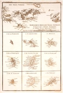
maps by rigobert bonne
old maps of dominica
old maps of saint lucia
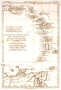
18th-century maps of barbados
maps from the mechanical curator collection
maps from the mechanical curator collection available to georeference
pictorial maps
barbados
1780 in the caribbean
virgin islands
saint vincent and the grenadines
maps of isla margarita
de nieuwe groote lichtende zee-fakkel (rijksmuseum)
maps in the rijksmuseum amsterdam
maps in the library of congress
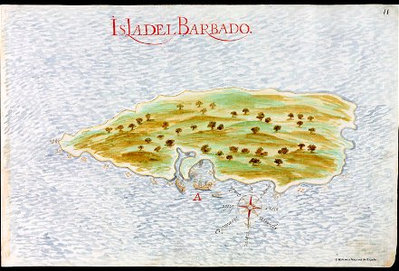
old maps of barbados
maps from the mechanical curator collection available to georeference
maps from the mechanical curator collection
the history of barbados; comprising a geographical and statistical description of the island (1848) by robert h. schombourgk
old maps of barbados
maps from the mechanical curator collection available to georeference
maps from the mechanical curator collection
the history of barbados; comprising a geographical and statistical description of the island (1848) by robert h. schombourgk
old maps of barbados
the history of barbados; comprising a geographical and statistical description of the island (1848) by robert h. schombourgk
old maps of barbados
the natural history of barbados (1750)
scotland district
18th-century maps of north america
1708 maps of north america
1 - 12 of 12
/ 1